Maps built around your information.
Interactive mapping experiences that bring together suitable addresses, places, boundaries, assets and events, with layers and controls chosen for the people using them.
 MAKE IT POSSIBLE. MAKE IT DEPENDABLE. MAKE IT BETTER.
MAPS / LOCATION INTELLIGENCE / CONNECTED CONTEXT
A pin tells you where something is. It rarely tells you what is happening around it, how things have changed, or what any of it means to the people who depend on that place.
We build maps and location-aware systems that bring geography, information and time together. From a question about one site to a picture across thousands of locations, we look for the connections that make the data useful.
Sometimes the answer is a clearer map. Sometimes the map is where the real question begins.
Two premises can be on the same road yet have very different experiences of a road closure. One might have another entrance. The other may depend on a single approach. A simple distance measurement can't tell you the whole story.
That distinction turns a map from something interesting to look at into something worth asking questions of. How do places connect? What changed? What happened here before? Which information is current, and what still needs checking?
We follow those questions beyond the pin. We connect relevant datasets, explore the relationships between places and events, and build ways for people to investigate the evidence themselves.
WHAT WE CAN HELP YOU CREATE
Sometimes you need a map for customers. Sometimes you need a way for your team to understand geography across an entire operation. We choose the method around the question.
Interactive mapping experiences that bring together suitable addresses, places, boundaries, assets and events, with layers and controls chosen for the people using them.
Investigate how one location relates to another, where a change happens and which journeys or approaches might deserve attention. We check the limits of the available geographic data.
Combine location with dates, histories and changing statuses so you can look backwards, understand what is happening and explore what may be coming next.
Geospatial data pipelines, spatial APIs, searchable applications, specialist dashboards or a focused proof of concept - designed to fit the question, not the other way round.
A SIMPLE EXAMPLE / NOT A CUSTOMER CASE STUDY
To somebody driving past, it might mean taking a different route home. To the person who runs the shop, it might mean deliveries arriving somewhere else, customers missing the entrance, or no meaningful change at all.
A map showing a closure is only the first piece. The more interesting questions are about the building, its entrances, connected roads, time of day and the evidence available for any claimed effect.
We can investigate those relationships and design tools that make them easier to explore. And if the evidence doesn't establish an impact, the system should say so rather than invent certainty.
That's the shift: from noticing an event to understanding whether it matters to a particular place.
 OUR OWN TECHNOLOGY / DISRUVIA
WHERE OUR OWN CURIOSITY LED
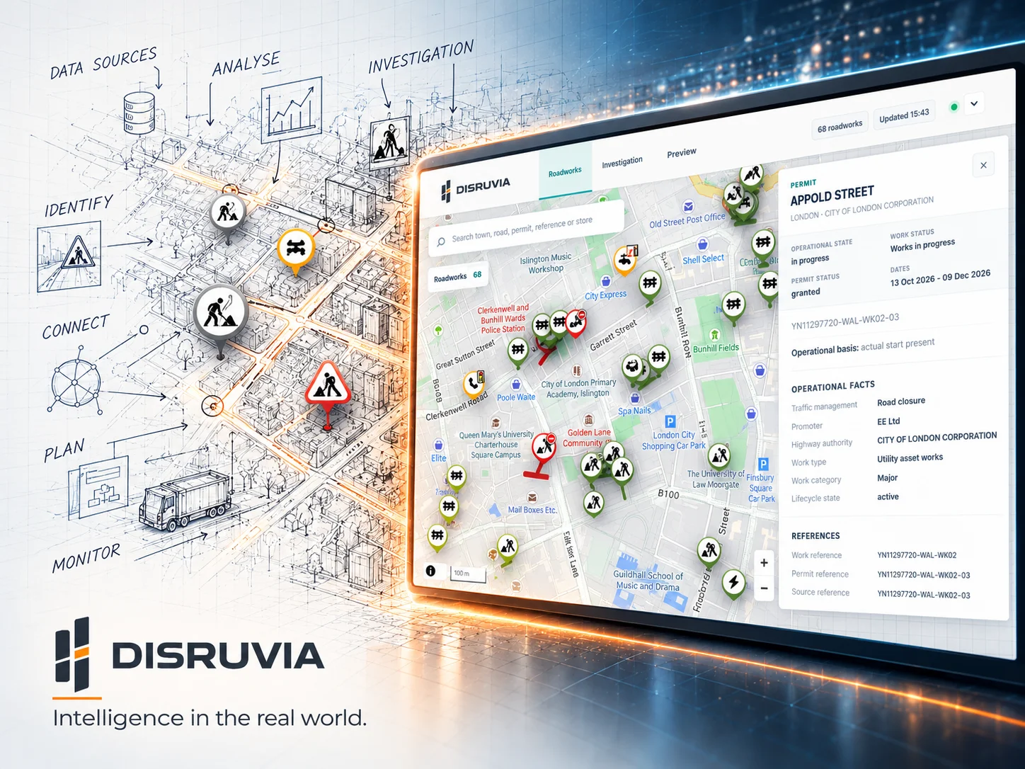
Our Disruvia project began with a familiar frustration: a journey disrupted by roadworks. We followed that question into the records behind the works, their changing timelines, the road network and the places affected by them.
The result is a platform showcase built around bringing together roadworks, history and geographic context. It illustrates the kind of thinking we bring to location-aware systems: keep asking, preserve the evidence, and make the answers easier to explore.
Disruvia is our own product work, not a claimed customer commission. The techniques are relevant far beyond roadworks, while any customer solution would be separately scoped to its information, geography and requirements.
Explore the Disruvia storyOTHER QUESTIONS WORTH EXPLORING
These are examples of possible applications, not projects we're claiming to have already delivered. Each depends on suitable data, permissions and feasibility.
Connect operational events with a network of sites to investigate where changes are occurring and where a response might be useful.
Explore routes, access points and location-based events so planners have more context when considering a delivery or visit.
Overlay appropriate boundaries, assets and datasets to reveal what overlaps, what's nearby and what requires closer investigation.
THE RISMOR WAY OF THINKING
We believe the best ideas often begin when someone notices a detail that doesn't quite fit. We bring human curiosity and practical understanding to the problem, use intelligent tools to explore possibilities and challenge our own first answers, then let the evidence decide what deserves to be built.
The exciting part is discovering a connection nobody had thought to ask about. The important part is proving it works with actual data, permissions, limitations and the people who will rely on it.
We want the result to be both imaginative and dependable. Neither quality matters much without the other.
MAKE IT DEPENDABLE
Good location intelligence depends on more than drawing geometry. We think through how the information was obtained and what it can genuinely support.
Are the coordinates right? How current is the record? Can somebody trace an important conclusion to its source?
Which mapping services and datasets may be used, displayed or shared? What does each licence permit?
Location information can reveal sensitive patterns. We consider appropriate access, retention and handling before connecting data.
A nearby event isn't proof of impact. We separate established facts, plausible indicators and questions that still need validating.
GOOD QUESTIONS
Not necessarily. We can investigate suitable existing information, supported external datasets or data your organisation already holds. Access rights, quality and coverage are checked before we agree an approach.
Potentially. We can assess the application's architecture, supported integrations and available geographic data to see whether an embedded map, spatial API or focused extension would be appropriate.
We can explore relevant geographic, timing and access information, but an impact claim needs appropriate evidence. Proximity alone cannot establish what will happen, and some questions may require local validation or additional sources.
No. Disruvia is our own roadworks-focused example; the underlying disciplines - spatial data, relationships, time, visualisation and applications - can be considered for many kinds of location-based questions.
That's a good place to start. We can explore the question, identify data and licensing constraints, compare approaches and, where worthwhile, test a small example before a larger build.
MAKE IT POSSIBLE. MAKE IT DEPENDABLE. MAKE IT BETTER.
Tell us the location, the information you have and the question you can't quite answer. It might lead to a simple view, a new connection or a completely different idea worth exploring.
Follow the question.
Find the connection.